

The First Continuous Traverse of the 4000-Footers of the Northeast
7/16/20-9/29/20 - 76 days, 115 peaks, ~301 miles of biking, ~970 miles of hiking, ~275k’ elevation gain

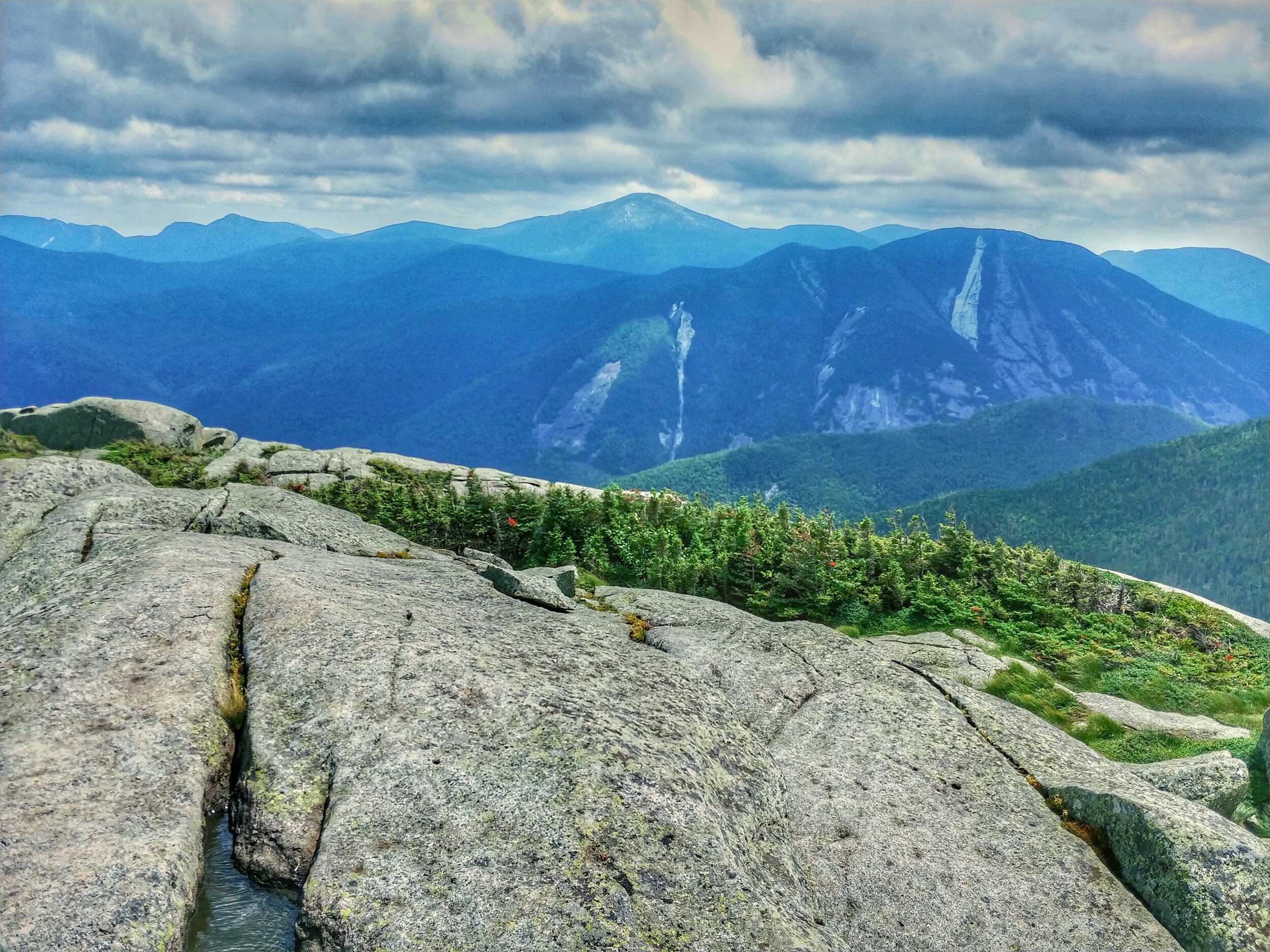
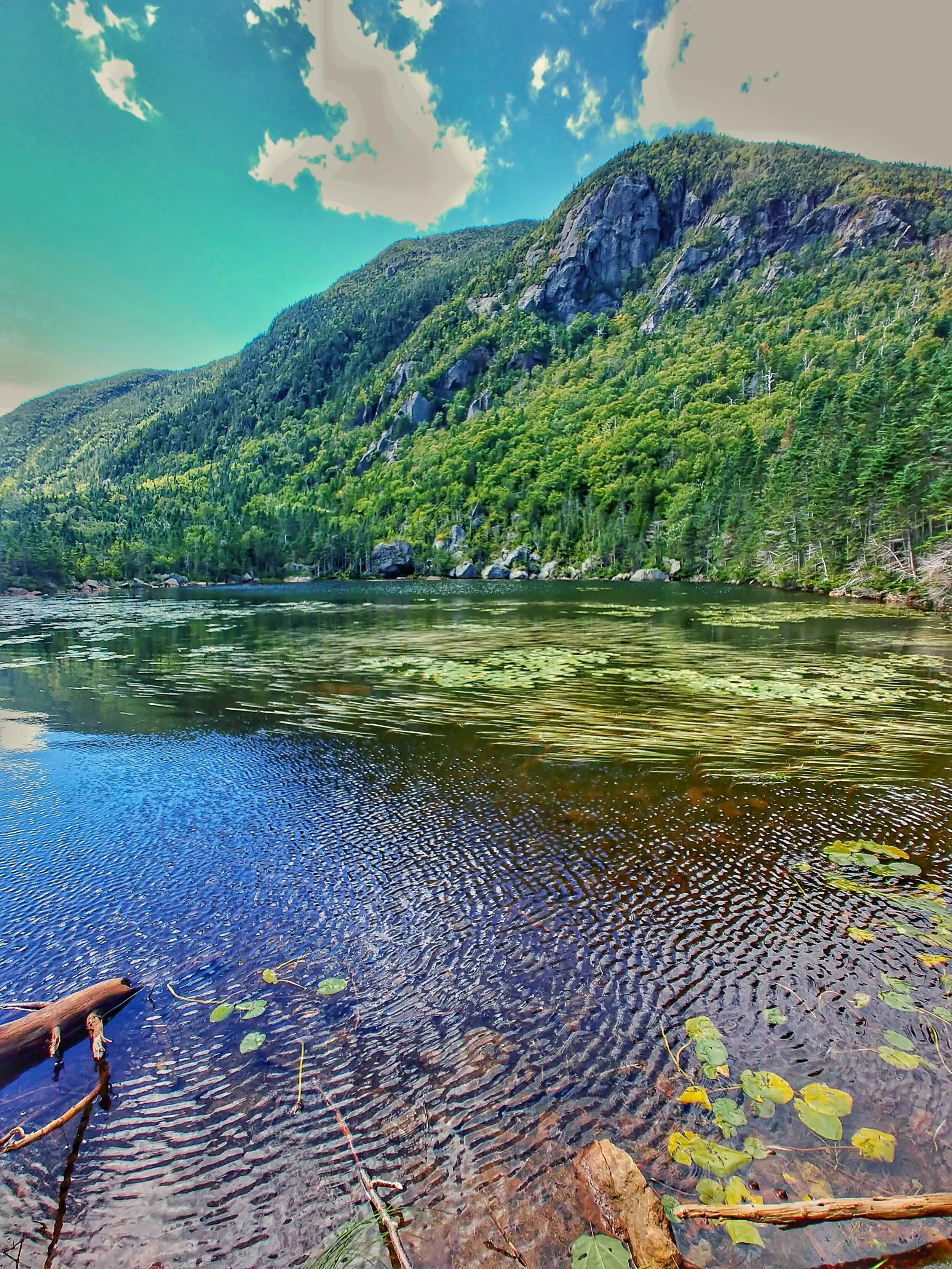
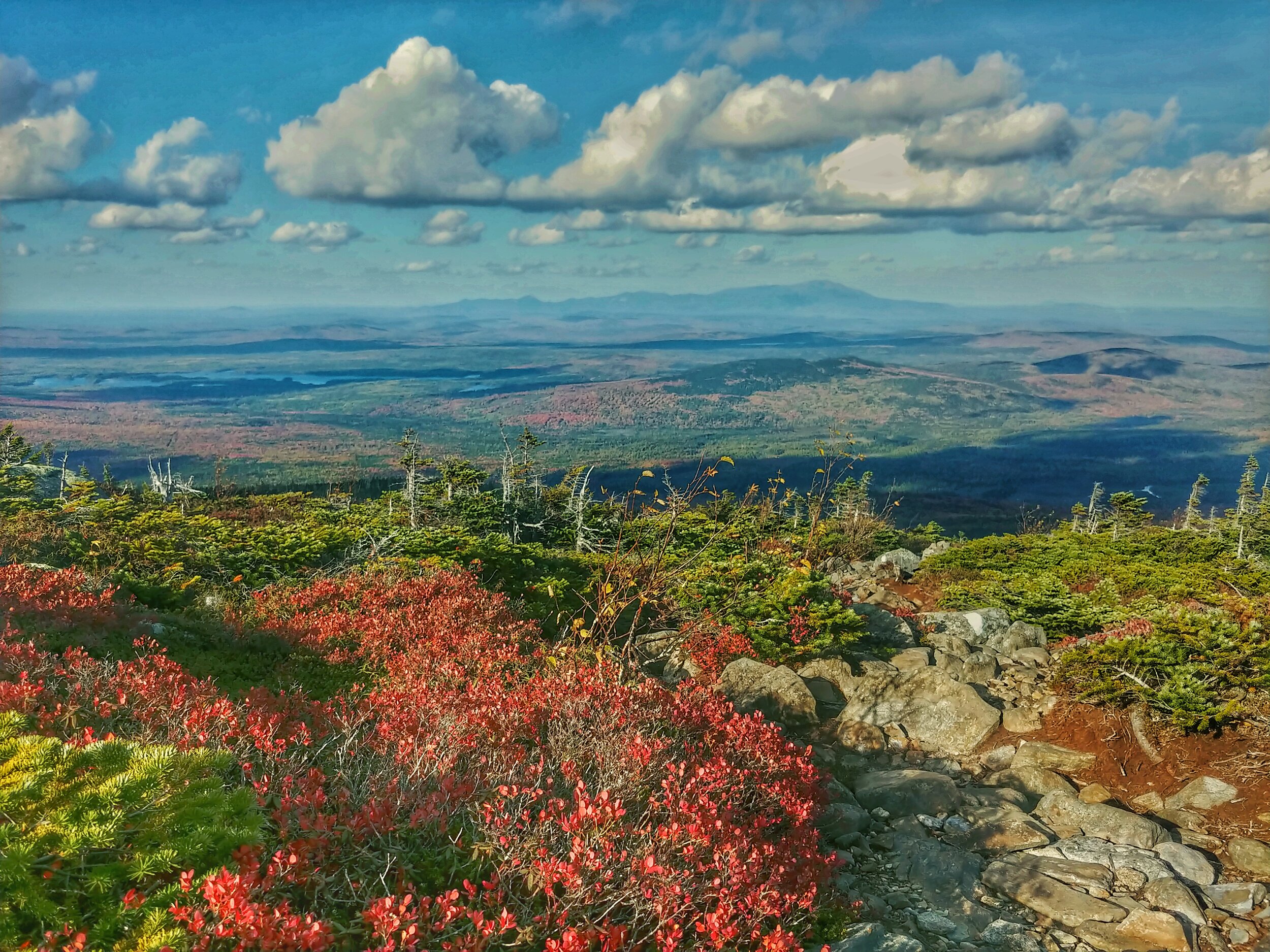
Looking at Gothics - Adirondacks, NY - August 2020
From mid-July to September 2020, I completed the first continuous traverse of the 115 4000-footers of the Northeast. This trip was the culmination of years of planning, learning, training, and recovery. I biked about 300 miles and hiked about 1000 miles over a continuous path with about 275k’ of elevation gain to complete this journey. In August 2014, I became the second person and first woman to thru-hike the Direttissima, which summits the 48 4000-foot mountains in New Hampshire. In June 2016, I became the first person to hike a similar route in Maine, thru-hiking the 14 4000-foot mountains in that state. I am particularly proud of the Maine hike, as it came after a lengthy recovery from a broken leg that included two surgeries, three plates, and 13 screws.
The Northeast 115 list combines the 48 peaks of New York, two in the Catskills and 46 in the Adirondacks, with the 67 in New England. There are five in the Green Mountains of Vermont, 48 in the White Mountains of New Hampshire, and 14 in Maine. The criteria for the Adirondack 46ers differs from the one used for the New England 67. The Adirondack list is composed of the peaks climbed by Robert and George Marshall, and Herbert Clark from 1918 to 1925. They climbed peaks over 4,000 feet with at least 300 feet of prominence or separated from the next closest summit by 0.75 miles. Modern surveys later showed four peaks to be under 4000’, but the list remains unchanged. The New England 67 4000-Footer list requires 200 feet of prominence and evolves with updates in survey data. The Catskill peaks are simply the two in the region over 4000 feet. The peaks share geologically recent shaping by glaciers and are discontinuous regions of the Northeastern Highlands ecosystem, with mostly northern hardwoods, northern hardwoods/spruce, and northeastern spruce-fir forests, with small pockets of above-treeline alpine areas.
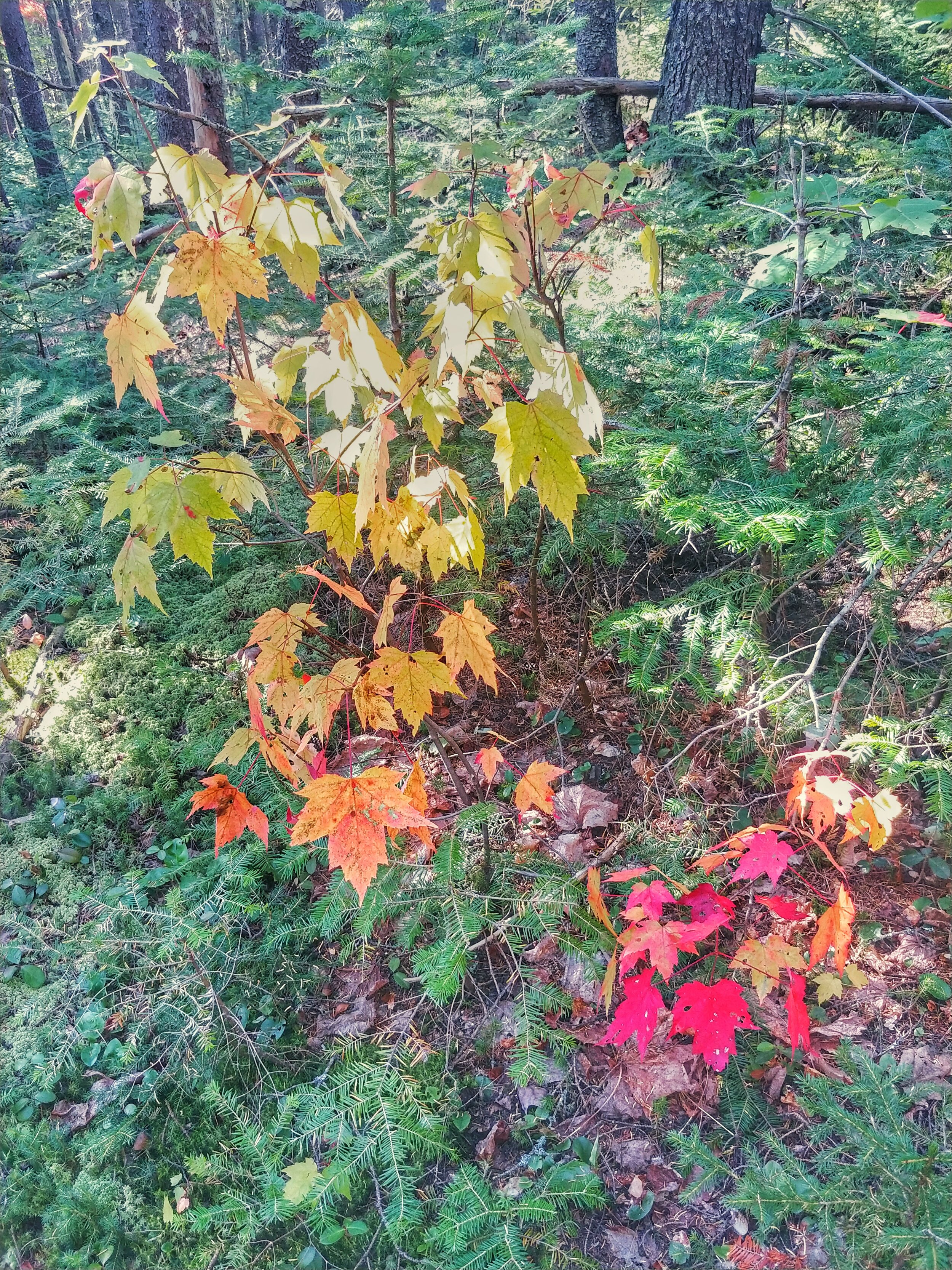
The route started at the summit of Slide Mountain, from the Slide-Cornell-Wittenberg trailhead at the Woodland Valley Campground outside of Phoenicia, NY. After hiking back to the same trailhead, I biked to the Becker Hollow Trail to do an out-and-back summit of Hunter Mountain. The Catskills look like rolling green hills from afar, but the hiking gets steep and rocky through the cloves carved by glaciers and running water. There were no views in the two foggy days I spent in this region, and my time there was over too quickly.
From there, I rode the bike about 220 miles north to the Seward Range trailhead on Coreys Road in the Adirondacks. I had no experience with bikepacking, but the novelty made it an exhilarating experience. My lack of familiarity with traveling by bike made me unsure of how many miles per day I should do. I was also riding while wearing my 55L backpacking pack, so my neck, back, and shoulders stiffened and became more painful with every day of riding. The days of biking featured typical Northeast humidity, temperatures in the 90s, and unrelenting sun. One of my favorite parts of backpacking is being able to see where you came from in the distance as you move across the land under your own power, and this was even more pronounced while biking. Suddenly a 30-mile day was taking it easy. I felt great upon getting into the Adirondacks and wondered how I would feel once I got on foot for about 200 miles.
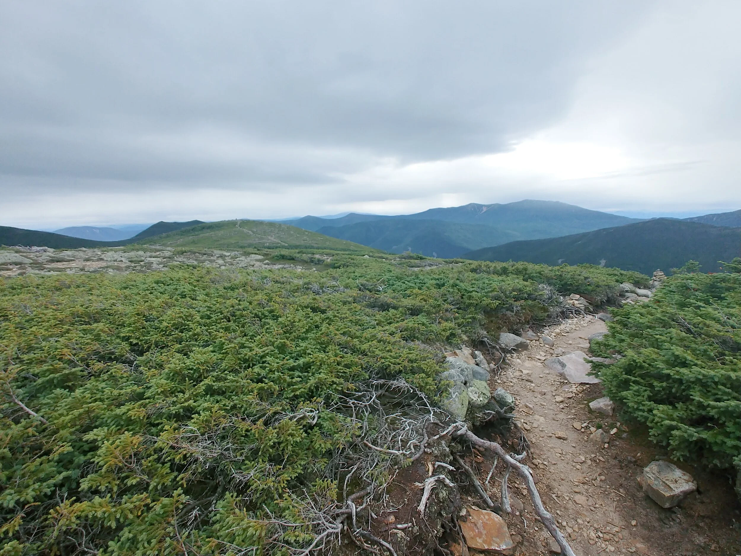
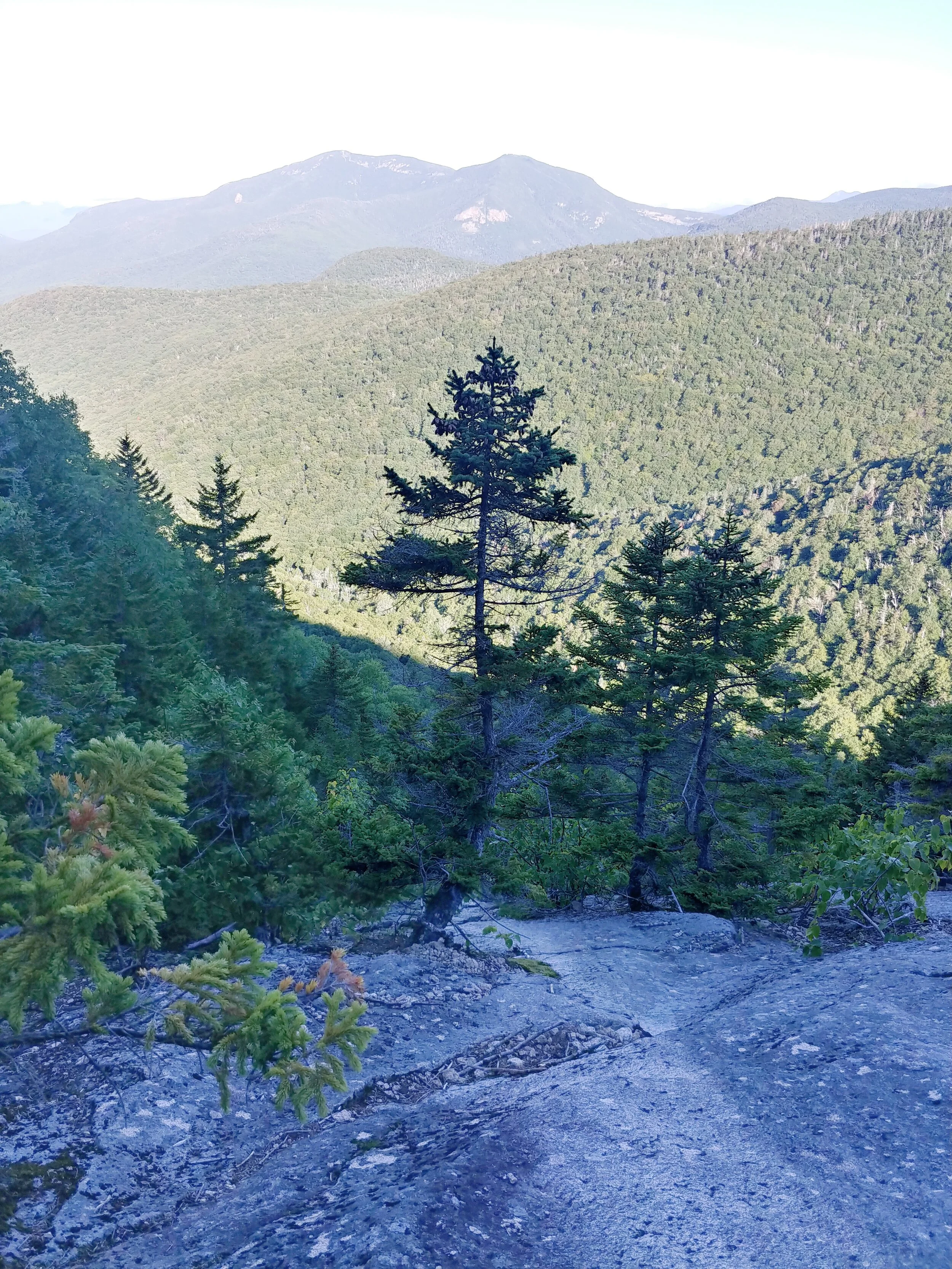
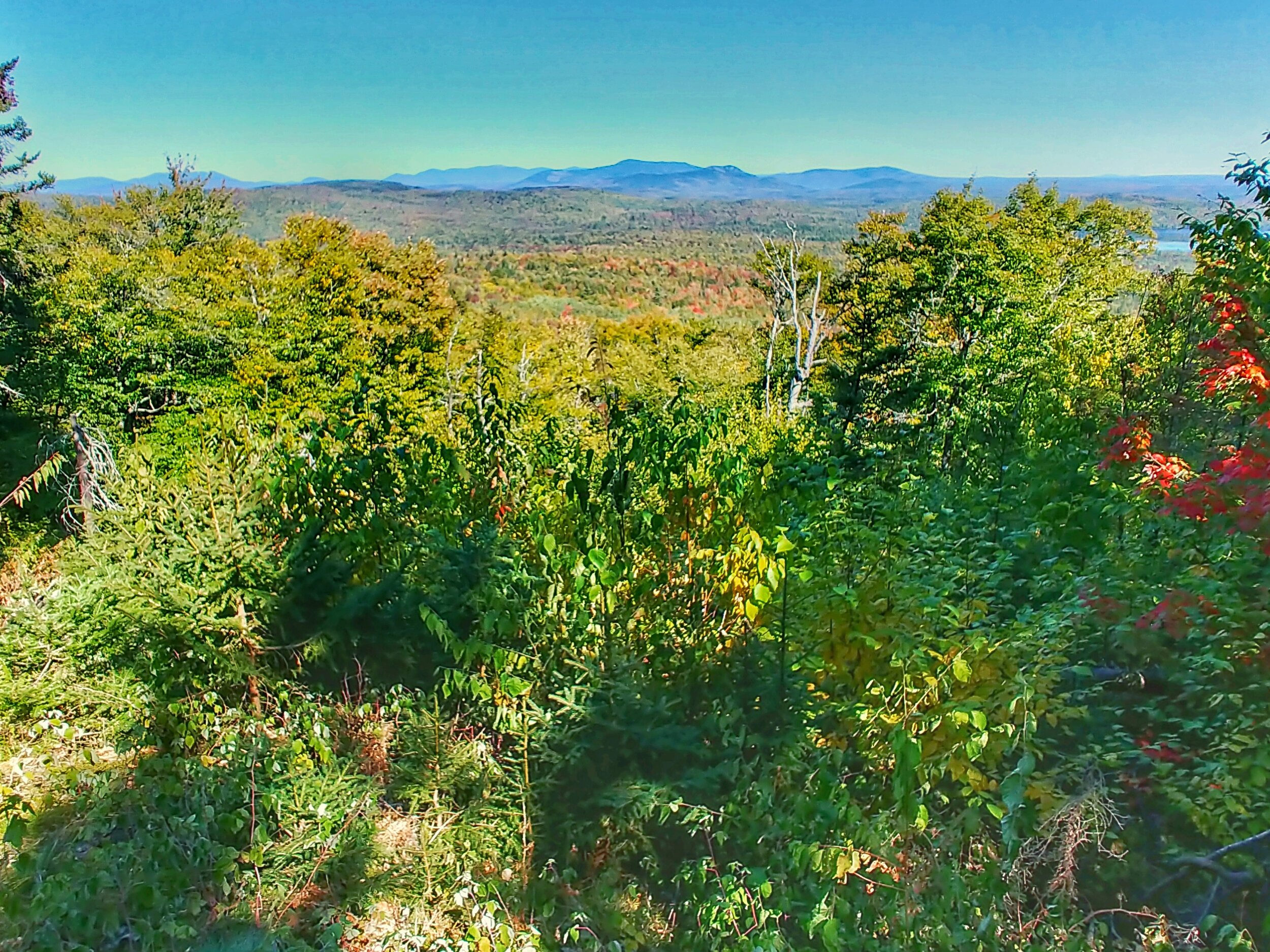
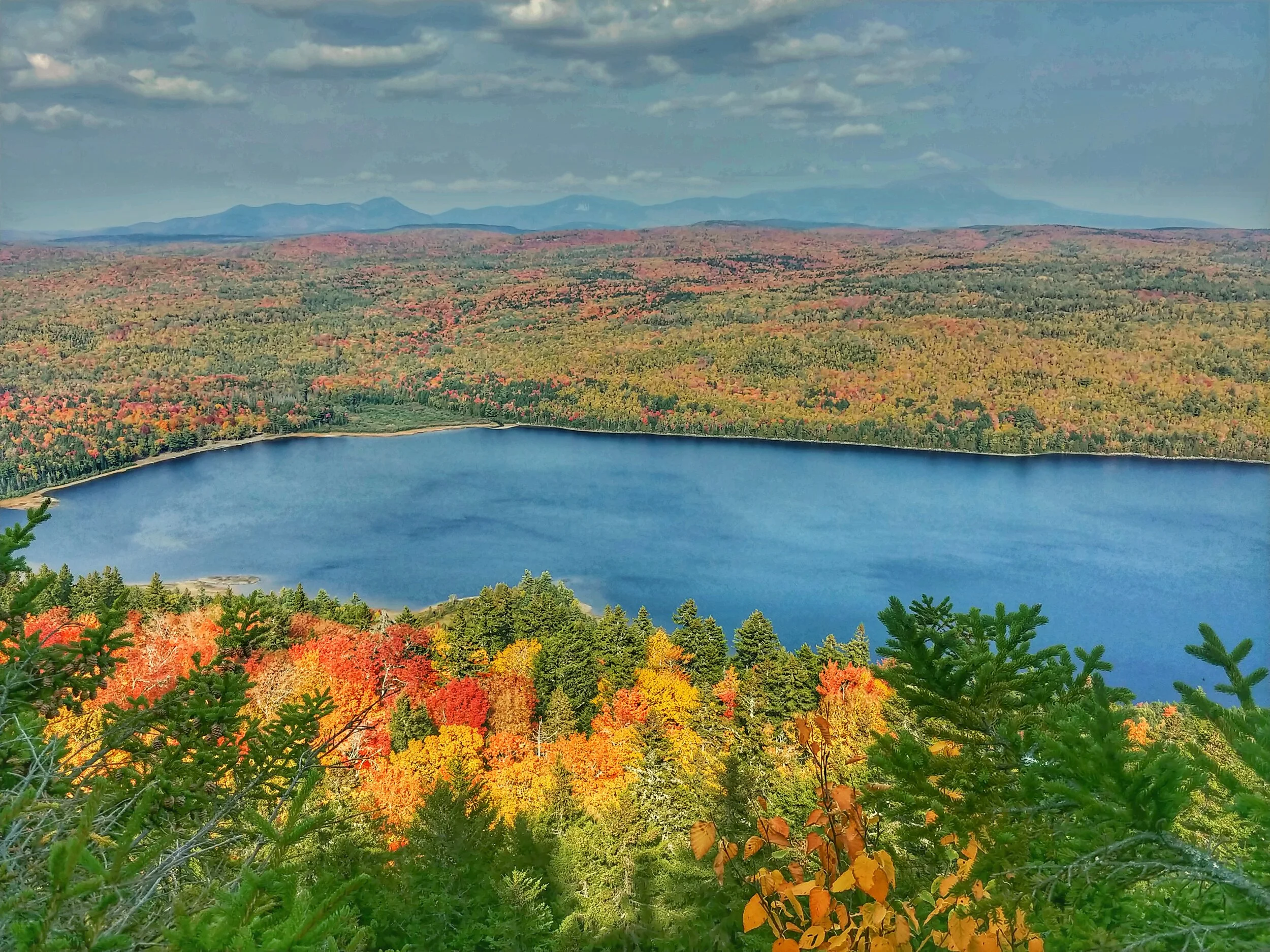
The route over the Adirondack 46ers was about 195 miles. I looked at this section as the crux of the trip. Before I started, I was confident I could complete the entire trip if I made it through the Adirondacks. I’d hiked the eastern High Peaks, MacIntyre Range and Great Range before, but about half of the peaks were new to me. The Adirondacks are geologically distinct from the Appalachian Mountains in New England and feature steep, slabby rock. Despite the low precipitation year, the mud and wetlands persisted. I started on the more remote east side of the High Peaks, and the deer flies were fierce in the valleys. I had great views on the ridges and summits of the Eastern High Peaks, but the vistas reached another level once I got to the MacIntyre Range and the many alpine summits of the Adirondacks.
Tropical Storm Isaias started to blow in the day I crossed the Dix Range, and I sustained multiple cuts and scrapes while I made several wrong turns in locating the herd path to Hough Peak. The next day I holed up in Keene Valley while the storm hit. With the region in a significant drought, there was little flooding and no significant damage to the trails I was hiking. Tropical Storm Irene heavily damaged the area in 2011, so I spent as much time worrying about whether I would be able to continue my hike as I did eating on my day off. Thankfully, there was minimal damage and flooding in most of the Northeast, and I could continue after the storm passed. After two relatively easy days, my time in New York was close to an end.
Once I summited Esther to complete the Adirondack 46ers and 4000-footers of New York State, I felt like I had a lot of hiking left in me, but I didn’t want to assume I’d already made it. I’d hiked about 220 miles and biked about 230 mi, which was only about a third of the way through the total miles. From here, I had the advantage that I had hiked the rest of the route in several sections before. While I had aches and pains all over, nothing stood out. I still felt strong.
I had used a zero in Lake Placid to move my bike from outside Tupper Lake to the Whiteface trailhead outside of Wilmington, NY. This wasn’t part of my original plan. My intention was to walk to Vermont after I completed the 46ers, but the ferry across Lake Champlain was only accepting bike and car passengers, no walk-on passengers. I was allowed to stand next to my bike though. It was about 80 miles of biking and one amazing ferry ride from Essex to Charlotte to get to Underhill State Park and start hiking for the rest of the trip.
I hiked up to Mount Mansfield via the Laura Cowles Trail, then followed the Long Trail for a little over 100 miles south to summit Camel’s Hump, Ellen and Abraham on the way to Killington. I’ve worked for the Green Mountain Club and hiked the Long Trail before, but I still underestimated the difficulty of northern Vermont. My shoes felt like they still had life in them when I’d gotten on the Long Trail, but it quickly became apparent I needed a fresh pair. My feet thanked me when I picked up that pair in Rutland before hiking up Killington. I then followed the Appalachian Trail to the Whites over an easier week than I’d had at any point on the trip. I looked at it as a recovery week.
Once I got over the Kinsmans, my route diverged from the AT to summit the NH48. I took a zero in Lincoln, NH, and learned that most of my belongings were stolen out of a storage unit I rented in Leadville, CO. Much of that day I spent contemplating whether I should go to Colorado and learn more about what happened to my stuff. I decided that wouldn’t help me get anything back and that I should keep going.
This was my second go at the NH 4000-footer Direttissima and it felt a lot easier than the first one. I felt better physically than at any other point on the trip through the Whites and had the confidence of having hiked the route before. I was unfocused in the wake of my things being stolen, but I just kept walking. Once I finished those peaks on Mount Cabot, I walked on roads for two days to reconnect with the Appalachian Trail at Speck Pond. The Maine peaks started with Old Speck, and I believe I completed the first full White Mountain Direttissima by linking the NH48 with the one peak geographically in the Whites in Maine.
By the time I’d made it to southern Maine, I was feeling worn out and struggled into central Maine. I’d once again kept the same pair of trail runners for too long, from Rutland, VT to Stratton, ME. It was just under 450 miles of use, but that’s too much for my feet on the rocks in New England. I slowed down a little, got a fresh pair of shoes, and took advantage of the frequent hiker hostels in Maine to refuel. All I needed was to eat more and take a zero in Stratton, ME.
Before I reached the Kennebec River ferry at Caratunk, ME, I was feeling ready to finish strong. I took a zero at Shaw’s Hiker Hostel in Monson, ME I didn’t plan or feel like I needed to spend some time hanging out with other hikers I’d met along the way. The Hundred Mile Wilderness was ablaze with fall colors as I traveled through. Upon entering Baxter State Park, I had to cover about 30 miles in a day to summit North Brother and follow the BSP camping rules. The next day, I hiked up to Hamlin and Baxter peaks to complete a dream I’d had for years. On to the next one.

Hiking in yellow, biking in orange. Link to CalTopo map.

Wed - 7/15/2020
Bike – Phoenicia to Woodland Valley Campground
Miles: 5.8 mi
Elevation Gain: 771’
Hike - Woodland Valley Campground to Wittenberg Dispersed Site
Miles: 4.4 mi
Elevation Gain: 2162’

Thu - 7/16/2020
Hike - Wittenberg Dispersed Site to Slide to Woodland Valley Campground
Miles: 2.6 + 7.0
Elevation Gain: 2717’
Bike – Woodland Valley Campground to Stony Clove Campground
Miles: 15.1 mi
Elevation Gain: 1345’
Peaks – Slide Mountain (10:22)

Fri - 7/17/2020
Bike – Stony Clove Campground to Becker Hollow Trailhead
Miles: 2.0 mi
Elevation Gain: 198’
Hike – Hunter via Becker Hollow Trail
Miles: 4.4 mi
Elevation Gain: 2165’
Bike – Becker Hollow Trailhead to Prattsville, NY
Miles: 19.0 mi
Elevation Gain: 472’
Peaks – Hunter Mountain

Sat - 7/18/2020
Bike – Prattsville, NY to Fultonville, NY
Miles: 59.6 mi
Elevation Gain: 2940’

Sun - 7/19/2020
Bike – Fultonville, NY to Speculator, NY
Miles: 54.3 mi
Elevation Gain: 2956’

Mon - 7/20/2020
Bike – Speculator, NY to Lake Durant Campground
Miles: 31.4 mi
Elevation Gain: 2520’

Tue - 7/21/2020
Bike – Lake Durant Campground to Tupper Lake, NY
Miles: 36.7 mi
Elevation Gain: 2353’

Wed - 7/22/2020
Tupper Lake, NY zero

Thu - 7/23/2020
Bike – Tupper Lake, NY to Coreys Rd
Miles: 7.3 mi
Elevation Gain: 502’
Hike – Coreys Rd to Blueberry Lean-to
Miles: 10.9 mi
Elevation Gain: 1010’

Fri - 7/24/2020
Hike – Blueberry Lean-to to Number 4 Lean-to
Miles: 17.4 mi
Elevation Gain: 6083’
Peaks – Seward – 08:39, Donaldson, Emmons, Seymour

Sat - 7/25/2020
Hike – Number 4 Lean-to to Bradley Pond Lean-to
Miles: 16.3 mi
Elevation Gain: 5305’
Peaks - Santanoni, Panther, Couchsachraga

Sun – 7/26/2020
Hike - Bradley Pond Lean-to to Calamity Lean-to
Miles: 21.5 mi
Elevation Gain: 5079’
Peaks - Allen

Mon – 7/27/2020
Hike - Calamity Lean-to to Heart Lake
Miles: 11.1 mi
Elevation Gain: 5413’
Peaks - Marshall, Iroquois, Algonquin, Wright

Tue – 7/28/2020
Lake Placid, NY zero

Wed – 7/29/2020
Heart Lake to Phelps Campsite
Miles: 11.4 mi
Elevation Gain: 3488’
Peaks - Street, Nye
Thu – 7/30/2020
Phelps Campsite to Feldspar Lean-to
Miles: 12.0 mi
Elevation Gain: 4862’
Peaks - Phelps, Tabletop, Colden
Fri – 7/31/2020
Hike - Feldspar Lean-to to Sno-Bird Campsite
Miles: 12.2 mi
Elevation Gain: 6216’
Peaks - Redfield, Cliff, Gray, Skylight, Marcy, Haystack

Sat – 8/01/2020
Hike - Sno-Bird Campsite to Wedge Brook Campsite
Miles: 12.2 mi
Elevation Gain: 5203’
Peaks - Basin, Saddleback, Sawteeth, Gothics, Armstrong, Upper Wolf Jaw, Lower Wolf Jaw

Sun – 8/02/2020
Hike - Wedge Brook Campsite to Bouquet Lean-to
Miles: 12.8 mi
Elevation Gain: 5637’
Peaks - Colvin, Blake, Nippletop, Dial

Mon – 8/03/2020
Hike - Bouquet Lean-to to Pull-off 1 mi from Five Peaks Trailhead
Miles: 13.1 mi
Elevation Gain: 5919’
Peaks - Dix, Hough, South Dix, Macomb, Grace

Tue – 8/04/2020
Hike – Keene Valley, NY zero

Wed – 8/05/2020
Hike - Pull-off 1 mi from Five Peaks Trailhe`ad to The Garden
Miles: 13.3 mi
Elevation Gain: 5620’
Peaks - Rocky Peak Ridge, Giant

Thu – 08/06/2020
Hike - The Garden to Cascade Inn
Miles: 22.3 mi
Elevation Gain: 7129’
Peaks - Big Slide, Porter, Cascade
Fri – 08/07/2020
Hike - Cascade Inn to Wilmington Trailhead
Miles: 20.3 mi
Elevation Gain: 4213’
Bike - Wilmington Trailhead to Ausable Chasm
Miles: 11.8 mi
Elevation Gain: 230’
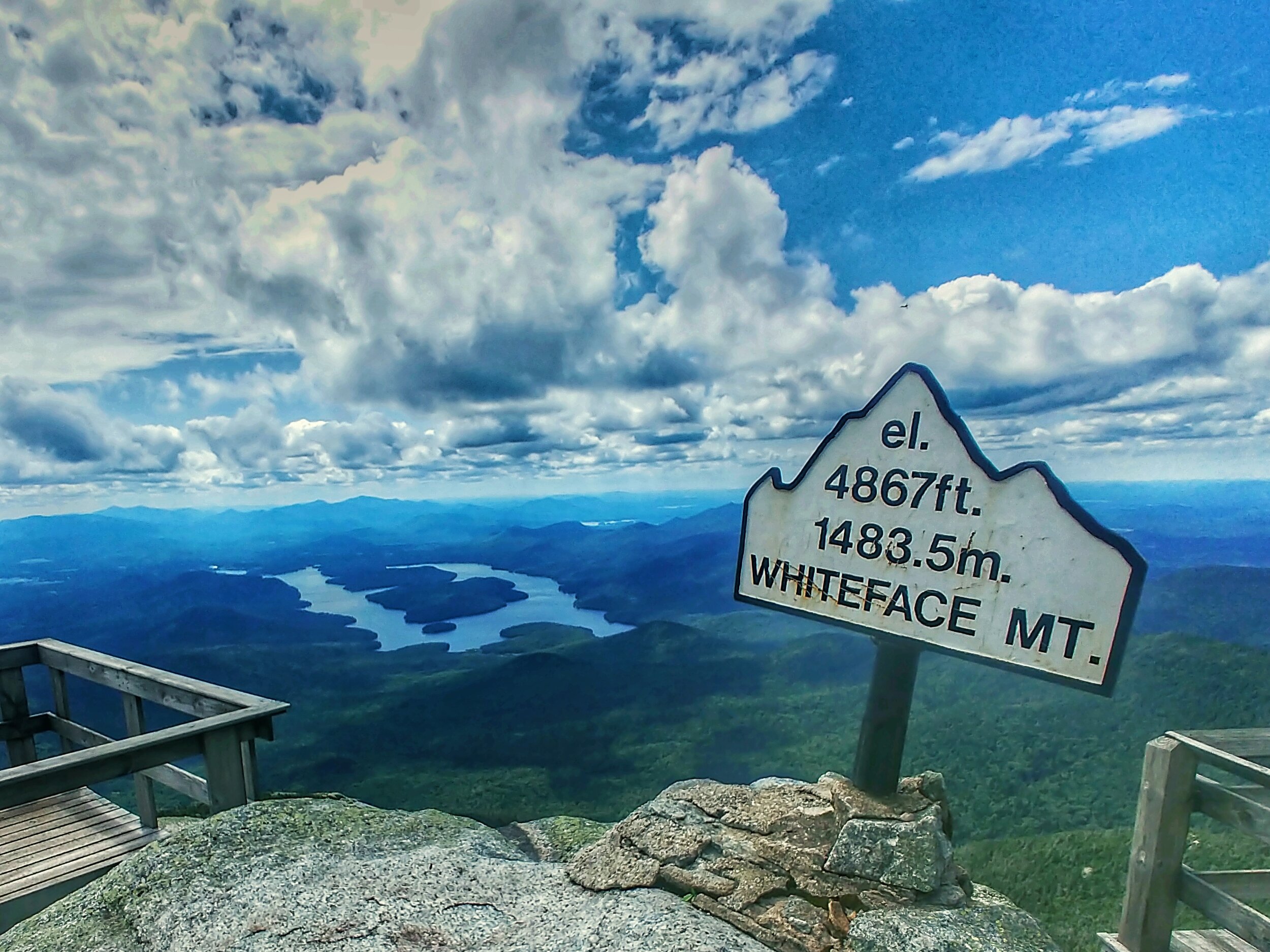
Peaks - Whiteface, Esther (15:20)

Sat – 08/08/2020
Bike - Ausable Chasm to Mountain Rd
Miles: 68.6 mi
Elevation Gain: 3389’
Hike - Mountain Rd to Underhill State Park
Miles: 2.9 mi
Elevation Gain: 1243’

Sun – 08/09/2020
Hike - Underhill State Park to Buchanan Shelter
Miles: 14.4 mi
Elevation Gain: 4964’
Peaks - Mansfield - 07:51

Mon – 08/10/2020
Hike - Buchanan Shelter to Duxbury Trailhead
Miles: 7.9 mi
Elevation Gain: 407’

Tue – 08/11/2020
Hike - Duxbury Trailhead to Cowles Cove
Miles: 14.6 mi
Elevation Gain: 5192’
Peaks - Camel’s Hump

Wed – 08/12/2020
Hike – Cowles Cove to Battell Shelter
Miles: 14.0 mi
Elevation Gain: 4116’
Peaks - Ellen, Abraham

Thu – 08/13/2020
Hike – Battell Shelter to Middlebury Ski Bowl
Miles: 21.7 mi
Elevation Gain: 4703’

Fri – 08/14/2020
Hike - Middlebury Ski Bowl to Rolston Rest Shelter
Miles: 21.8 mi
Elevation Gain: 5190’

Sat – 08/15/2020
Hike - Rolston Rest Shelter to Inn @ Long Trail and Killington Roundtrip
Miles: 15.3 mi
Elevation Gain: 4447’
Peaks - Killington

Sun – 08/16/2020
Rutland, VT zero

Mon – 08/17/2020
Hike - Inn @ Long Trail to Winturri Shelter
Miles: 21.8 mi
Elevation Gain: 4695’

Tue – 08/18/2020
Hike - Winturri Shelter to Hanover, NH
Miles: 23.1 mi
Elevation Gain: 5699’

Wed – 08/19/2020
Hike - Hanover, NH to Moose Mountain Shelter
Miles:12.2 mi
Elevation Gain: 3192’

Thu – 08/20/2020
Hike - Moose Mountain Shelter to Hexacuba Shelter
Miles: 17.4 mi
Elevation Gain: 5341’

Fri – 08/21/2020
Hike - Hexacuba Shelter to NH 25C
Miles: 10.6 mi
Elevation Gain: 2257’
Sat – 08/22/2020
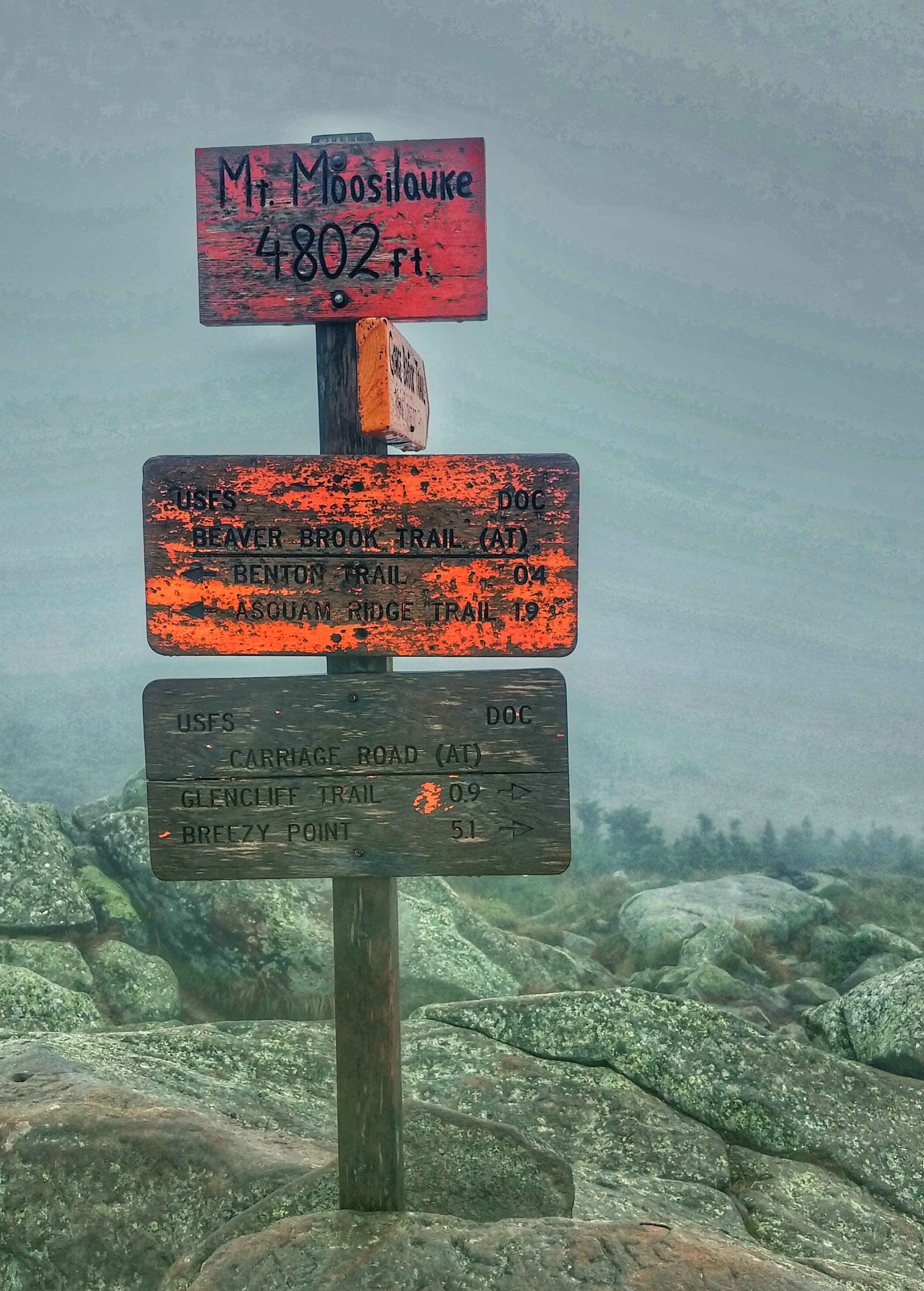
Hike – NH 25C to NH112
Miles: 12.5 mi
Elevation Gain: 4941’
Peaks - Moosiluake

Sun – 08/23/2020
Lincoln, NH zero

Mon – 08/24/2020
Hike – NH112 to Kinsman Pond Shelter
Miles: 13.0 mi
Elevation Gain: 4826’
Peaks - South Kinsman, North Kinsman

Tue – 08/25/2020
Hike – Kinsman Pond Shelter to Liberty Spring Tentsite
Miles: 10.4 mi
Elevation Gain: 6132’
Peaks - Cannon, Lafayette, Lincoln

Wed – 08/26/2020
Hike – Liberty Spring Tentsite to Garfield Shelter
Miles: 21.8 mi
Elevation Gain: 6444’
Peaks - Liberty, Flume, Owl's Head, Garfield
Thu – 08/27/2020
Hike – Garfield Shelter to Guyot Shelter
Miles: 18.9 mi
Elevation Gain: 7333’
Peaks - Galehead, South Twin, North Twin, Hale, Zealand

Fri – 08/28/2020
Hike – Guyot Shelter to NH112
Miles: 21.7 mi
Elevation Gain: 4908’
Peaks - West Bond, Bond, Bondcliff, South Hancock, North Hancock

Sat – 08/29/2020
Lincoln, NH zero

Sun – 08/30/2020
Hike – NH112 to Livermore Trail Dispersed Site
Miles: 15.5 mi
Elevation Gain: 5810’
Peaks - East Osceola, Osceola, Tecumseh
Mon – 08/31/2020
Hike – Livermore Trail Dispersed Site to Sawyer Pond Shelter
Miles: 21.8 mi
Elevation Gain: 5889’
Peaks - North Tripyramid, Middle Trypyramid, Whiteface, Passaconaway

Tue – 09/01/2020
Hike – Sawyer Pond Shelter to Ethan Pond Shelter
Miles: 15.2 mi
Elevation Gain: 4186’
Peaks - Carrigain

Wed – 09/02/2020
Hike – Ethan Pond Shelter to Nauman Tentsite
Miles: 13.3 mi
Elevation Gain: 5125’
Peaks - Willey, Field, Tom, Jackson

Thu – 09/03/2020
Hike – Nauman Tentsite to Glen Ellis Trailhead
Miles: 18.7 mi
Elevation Gain: 5604’
Peaks - Pierce, Eisenhower, Monroe, Washington, Isolation
Fri – 09/04/2020
Hike – Glen Ellis Trailhead to Dolly Copp Campground
Miles: 19.7 mi
Elevation Gain: 8087’
Peaks - Wildcat D, Wildcat A, Carter Dome, South Carter, Middle Carter, Moriah

Sat – 09/05/2020
Hike – Dolly Copp Campground to Waumbek Trailhead
Miles: 20.4 mi
Elevation Gain: 6909’
Peaks - Madison, Adams, Jefferson

Sun – 09/06/2020
Hike – Waumbek Trailhead to Cabot Cabin
Miles: 15.0 mi
Elevation Gain: 6493’
Peaks - Waumbek, Cabot

Mon – 09/07/2020
Hike – Cabot Cabin to Berlin, NH
Miles: 20.9 mi
Elevation Gain: 817’

Tue – 09/08/2020
Gorham, NH zero

Wed – 09/09/2020
Hike – Berlin, NH to Speck Pond Shelter
Miles: 14.4 mi
Elevation Gain: 2838’

Thu – 09/10/2020
Hike – Speck Pond Shelter to East B Hill Rd
Miles: 16.3 mi
Elevation Gain: 4767’
Peaks - Old Speck

Fri – 09/11/2020
Hike – East B Hill Rd to South Arm Rd
Miles: 10.1 mi
Elevation Gain: 3488’

Sat – 09/12/2020
Hike – South Arm Rd to Sabbath Day Pond Shelter
Miles: 16.0 mi
Elevation Gain: 4751’

Sun – 09/13/2020
Hike – Sabbath Day Pond Shelter to ME 4
Miles: 9.4 mi
Elevation Gain: 1526’

Mon – 09/14/2020
Hike – ME 4 to Orbeton Stream Dispersed Site
Miles: 12.4 mi
Elevation Gain: 4783’
Peaks - Saddleback, The Horn

Tue – 09/15/2020
Hike – Orbeton Stream Dispersed Site to Carrabassett River Dispersed Site
Miles: 15.0 mi
Elevation Gain: 4918’
Peaks - Abraham, Spaulding, Sugarloaf

Wed – 09/16/2020
Hike – Carrabassett River Dispersed Site to ME 27
Miles: 10.8 mi
Elevation Gain: 3776’
Peaks - South Crocker, Redington, North Crocker

Thu – 09/17/2020
Rangeley, ME zero

Fri – 09/18/2020
Hike – ME 27 to Flagstaff Lake
Miles: 16.3 mi
Elevation Gain: 3907’
Peaks - Bigelow, Avery

Sat – 09/19/2020
Hike – Flagstaff Lake to US 201
Miles: 15.8 mi
Elevation Gain: 1877’
Sun – 09/20/2020
Hike – US 201 to Moxie Bald Lean-to
Miles: 18.8 mi
Elevation Gain: 4547’
Mon – 09/21/2020
Hike – Moxie Bald Lean-to to ME 15
Miles: 18.8 mi
Elevation Gain: 2507’

Tue – 09/22/2020
Monson, ME zero

Wed – 09/23/2020
Hike - ME 15 to Cloud Pond Lean-to
Miles: 19.1 mi
Elevation Gain: 5249’
Thu – 09/24/2020
Hike - Cloud Pond Lean-to to Logan Brook Lean-to
Miles: 22.2 mi
Elevation Gain: 5272’

Fri – 09/25/2020
Hike - Logan Brook Lean-to to Potaywadjo Spring Lean-to
Miles: 21.8 mi
Elevation Gain: 2087’
Sat – 09/26/2020
Hike - Potaywadjo Spring Lean-to to Hurd Brook Lean-to
Miles: 29.1 mi
Elevation Gain: 3661’

Sun – 09/27/2020
Hike - Hurd Brook Lean-to to Abol Bridge Campground
Miles: 4.2 mi
Elevation Gain: 371’

Mon – 09/28/2020
Hike - Abol Bridge Campground to The Birches
Miles: 29.5 mi
Elevation Gain: 6690’
Peaks - North Brother

Tue – 09/29/2020
Hike - The Birches to Katahdin
Miles: 8.3 mi
Elevation Gain: 5285’
Peaks - Hamlin, Katahdin