

New Hampshire 48 Direttissima
August 2014

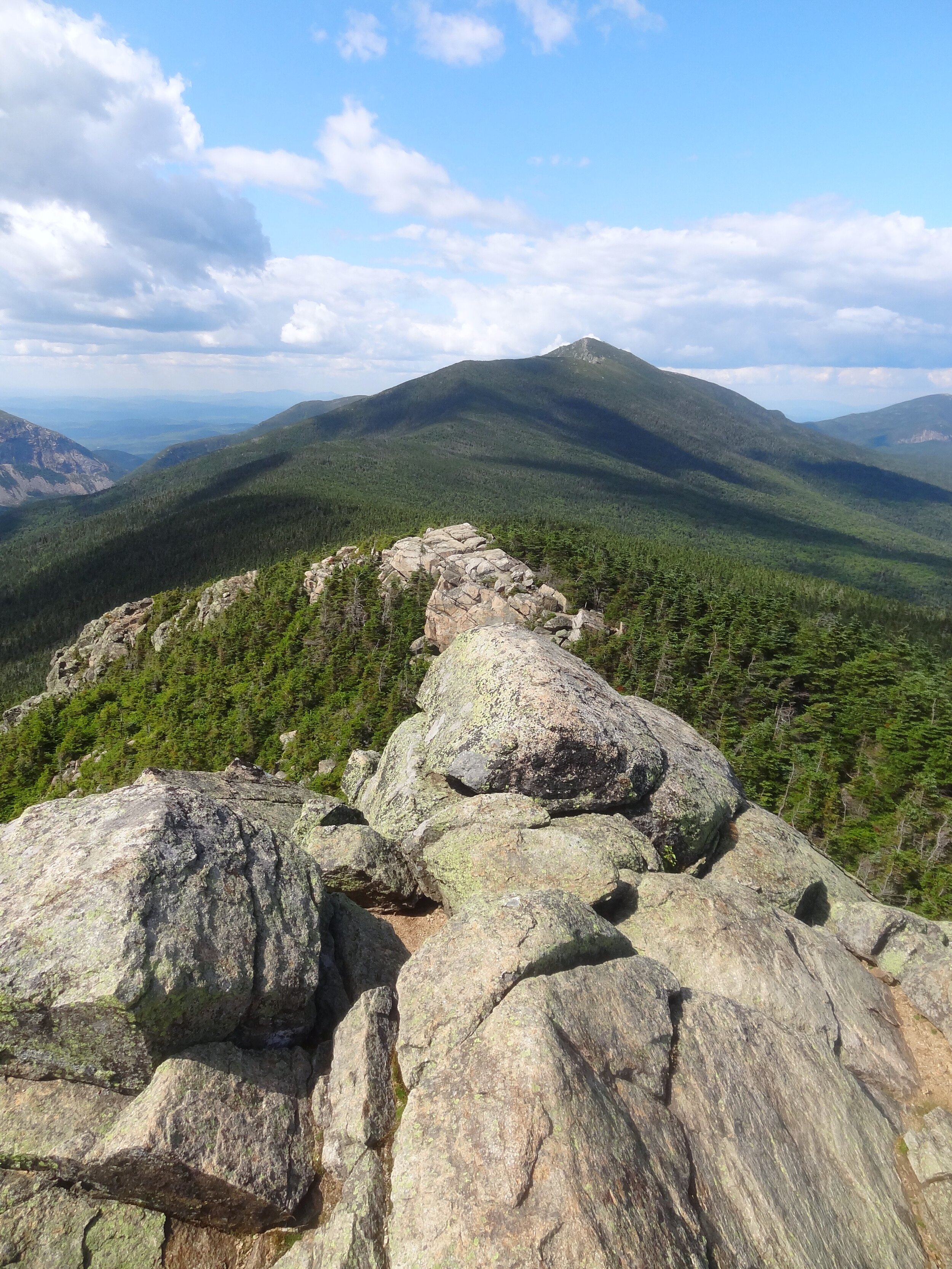
Northern Presidentials from Moriah
I first learned about the Direttissima while reading Four Thousand Footers of the White Mountains by Steve Smith. In a December 1971 story in Appalachia Magazine, Rev. Henry T. Folsom wrote about his vision of a White Mountain Direttissima: a continuous footpath connecting the summits of the (at the time) 46 4000-footers. He invited others to do this hike along established, signed trails and roads accessible to cars. He completed the route in 1969, from Cabot to Moosilauke over 19 non-continuous days, spending some nights in the woods and some out. I tried to stay true to this spirit in my planning but was not aware he stuck to established trails. I took the unofficially maintained Fire Warden’s Trail, and an abandoned woods road, Carrigain Brook Road.
I didn't have a solid start date in mind for this trip; I had most of August to do it. I'd been watching the weather forecast on Mt. Washington somewhat obsessively all summer (this isn't just a summer habit of mine) and practically ran out of my house once I saw a forecast for a five-day window of good weather. That almost never happens in the Whites. I was calling the trip "self-supported" and I'd set a pretty simple set of rules for the game of this little hike: Anything I'd mailed myself, that came to me by serendipity (food, booze, hitches, etc.) or was available to all hikers (campsites, shelters, shuttles, etc.) was fair game. I planned on hitching into Lincoln to pick up a mail drop, eat pizza, drink beer, and visit Chet's after around 90 miles.
Jump to:
8/8 (Fri)–Beaver Brook Shelter →Moosilauke →Kinsman Pond Shelter
8/9 (Sat) - Kinsman Pond Shelter → Lincoln Brook campsite
8/10 (Sun) - Lincoln Brook campsite → Galehead campsite
8/14 (Thu)–NH 112 → Livermore Trail campsite
8/15 (Fri)-Livermore Tr campsite → Sawyer Pond Campsite
8/16 (Sat)-Sawyer Pond Campsite → Ethan Pond Campsite
8/17 (Sun)–Ethan Pond Campsite → Nauman Tentsite
8/18 (Mon)-Nauman Tentsite → Glen Ellis Parking Lot
8/19 (Tue)-Glen Ellis Parking Lot → Imp Shelter
8/20 (Wed)-Imp Shelter → Madison campsite

Sunrise at Beaver Brook Shelter
8/8 (Fri)–Beaver Brook Shelter →Moosilauke →Kinsman Pond Shelter–15.3 (+2.3) mi- +5935’ -5896’

Peaks: Moosilauke–06:42, S Kinsman–15:54, N Kinsman - ~16:20
Woke up to a beautiful sunrise over Franconia Ridge. Everyone in the shelter had gone to bed at 9 pm and then woke up at 5 am. It was beautiful; I'd never seen it go off so close to clockwork. Got up to Moosilauke at 06:42. Somewhat foggy, windy, and cool. I called my grandmother from Beaver Brook shelter when I got back down there and hung out for a while. I was hoping to catch some free food once I got back down to the trailhead, but no luck. It was okay; I was carrying plenty. I still spent a long time thinking about cheeseburgers.
I thought the Kinsman Ridge Trail was a much rougher ascent than the Beaver Brook Trail. It had a lot less trail work in comparison. It was a steep and tough, but beautiful climb up South Kinsman. I'd hiked the Kinsmans before, coming from the opposite direction that I was currently hiking. There was a rock throne at the top of South Kinsman I definitely didn't see the last time I was there. I guess I didn't get to the actual summit on my previous trip. A couple of Nobos were there and took a picture of me on the throne. North Kinsman was a minor bump I came upon sooner than I expected. I didn't realize I went over it and forgot to take a picture from the summit.
There were amazing views of Franconia Ridge from both peaks. The weather was perfect- sunny and cool with a forecast for it to continue. I considered going a little farther when I got to the shelter at Kinsman Pond. I asked the caretaker if there were any decent spots to camp between Kinsman Pond and the summit of Cannon and he said the woods were too thick to find a suitable spot. It worked out great. I got a delicious pita pizza from a kid running a summer camp trip through Camp Merra Vista at the shelter. Can't beat this stuff.

Sitting on the throne of South Kinsman
8/9 (Sat) - Kinsman Pond Shelter → Lincoln Brook campsite - ~21.2 mi - +6460’ -8586’

Peaks: Cannon–08:57, Lafayette–13:08, Lincoln–13:32, Liberty–15:21, Flume–16:01
Long day starting with the Cannonballs and up the steep and rocky summit cone of Cannon. I enjoyed splendid views of Franconia Ridge again today when I got to the top. There was a big ski lodge up there with a wooden viewing deck. Picture perfect blue skies and it was still cool enough that I was hiking in a windbreaker. The summit would have been an interesting place to camp, but the Cannonballs were rough enough that I was glad I stayed at the shelter. It was too early in the trip to push the miles.
After a steep descent down to Lafayette Campground, I crossed Highway 93 to head up the Old Bridle Path. I could have stopped to get some snacks and take a shower, but didn't. I took advantage of the flush toilets and kept going.
Once across the highway, I climbed Old Bridle Path and stopped for lunch at Greenleaf Hut, where I had a slice of quiche and some bread that powered me up Lafayette. I moved quickly along a very crowded Franconia Ridge, stopping at the packed summit of Lincoln. What do you expect on a beautiful weekend day? I snapped a picture of myself at the summit. When I looked at it, I realized there was a girl right behind me in the picture also taking a selfie. I hadn't noticed her there, but I laughed that we were both taking pictures of ourselves, completely oblivious to each other.
I dropped a couple of hundred feet to the Liberty Spring Tentsite for some water before heading back up. After I got back on the ridge, I headed south to Liberty, then Flume. I didn't wind up needing the extra water. Hiking from Greenleaf Hut to the bottom of the Osseo Trail seemed like a long stretch with 2 liters, but that was enough for me.
Once I descended the Osseo Trail, I followed the old (and flat!) rail trails until finding a place to camp along the Lincoln Brook Trail, about a mile or so before the Franconia Brook Trail. About 21.2 mi for the day. My legs felt pretty good, a lot better than I expected. I really enjoyed my little dispersed campsite and my first night under my Six Moon Designs Gatewood Cape on this trip. There was plenty of room for me and all my stuff, and it vented well.
Looking back at Franconia Ridge
8/10 (Sun) - Lincoln Brook campsite → Galehead campsite–17.5 mi - +6493’ -4272’

Peaks: Owl’s Head–11:35, Garfield–16:16, Galehead–19:46
I spent the day slogging on hot, humid, and flat trails with steep and quick ascents to the summits of the day. The Owl's Head Slide was scree and talus then slabby rock for about 1500'. Then came some wandering along the many herd paths on the flat summit to a rock cairn. I came down the slide and turned north towards the 13 Falls Campsite. The Franconia Brook Trail was easy to follow after a confusing area close to the trail to the slide. Met a very cool caretaker named Dylan by the campsite and talked to him for 20 or 30 minutes. Soaking my feet in the river for another half hour before I got moving again was a highlight of my day.
It was a steady, moderate climb up Franconia Brook Trail to reconnect with the AT and then a quick but very steep up and down Garfield. That part of the Twinway gains 1100' in 0.7 mi, and the first quarter-mile is mostly flat. Met up with the Nobos I'd seen on South Kinsman a few days ago. I told them the trail isn't as bad once you get down Garfield. It mellows out after the "Garfield Waterfall," but I never said it was easy. I started off towards Galehead at a pace that represented my ambitious goal of covering the 3.1 miles to the hut in time for a chance to do work for stay. It's something I'd like to experience and thought this trip was my best opportunity to do one. I'd be out in the Whites a lot longer than any of the thrus. I made it in time, but a boy who looked about 19 said no. Not because I'd be taking a spot from a thru-hiker, but "out of respect for our paying guests." The paying guests and thru-hikers were all on board with me sleeping on the floor. I'd have felt the same the times I've been a paying guest at the huts, but that's how it goes. It rubbed me the wrong way, but I knew where to camp nearby.
I got an earful from the Nobos I ran into earlier when they arrived. They weren't big fans of the rocky trail between Garfield and Galehead. Welcome to the Whites. They also told me I should've told the croo I was a thru-hiker. I'd rather not lie about what I'm doing.
I found an okay place to camp nearby and headed up to the Galehead summit. A nasty thunderstorm rolled in while I was on the way up. The flash of my camera got destroyed trying to take a picture at the summit in the pouring rain. When I got back down to my tarp, the Capilenes I was wearing under my shorts were soaked. Since they were warm, I didn't realize how wet I was when I got in my sleeping bag. As a result, I had a pretty damp and chilly night since my down bag got a little wet and the temperature was in the mid-40s. At least I wouldn't have to put on cold and wet long johns in the morning.

The last picture with flash my camera ever took
8/11 (Mon)–Galehead → Guyot–16.7 mi- +6496’ -6237’

Peaks: S Twin–08:13, N Twin–09:04, Hale–12:10, Zealand–16:35, W Bond–19:59
I woke up still a little damp and had a few cups of coffee while procrastinating about getting on the trail at Galehead. It had become a warm and sunny day by the time I made the steep South Twin ascent, so I set my damp stuff out on the rocks to dry. I took in the sweeping views as I ate. Surprisingly, there was almost no wind at the summit, so I stayed awhile.
After I packed up, I started down the North Twin Trail in search of the unmaintained Fire Warden's Trail. It's about three miles from the North Twin summit. I ran into a day hiker and got some friendly advice on where to find it. It turned out to be one of the nicer and more un-Whites like ascents of my trip. A moderate climb on a dirt trail was a delightful change of pace from all rocks, all the time. It was still warm and sunny, and my clothes were still wet, so I laid them out on the summit cairn of Hale and had some snacks.
Made my way to Zealand Hut and saw the same thru-hikers I'd seen at South Kinsman, Garfield, and Galehead. I'm so bad with names, one of them is Torch or something like that, and I have no idea what the other one's name is. It's weird that I keep veering on and off the AT and still winding up in the same place at the same time as them. The croo was looking to get rid of some old food, so I ate four bowls of beef stew and drank a bunch of coffee while my socks and shoes dried on the porch. After about two hours lounging around, I decided I should get moving again. I packed up and set off going south on the AT, now going back towards South Twin.
I climbed some short, steep sections, up and down, before I got to the viewless summit of Zealand. I'd done this stretch of trail in this direction before. It was rougher than I'd remembered. I continued past the rocky, open Guyot, which doesn't count as an AMC 4000-footer because I don't know why. It appears to have the prominence to qualify.
It was overcast. I was going in and out of the clouds, with occasional drizzle. I was mostly dry though. Once I got to Guyot shelter, I found it was shockingly crowded for a Monday night. Almost everyone was commenting on how they thought no one else would be there. I made some dinner and tried to Yogi for some food ("Wow, those meatballs sure do look good!"). I failed. Some people at the shelter were talking about how great the sunset is from West Bond.
When I checked the time, it was less than 20 minutes before sunset and about a mile away, so I hurried over to see it. I missed the best views by a couple of minutes and didn't hang out at the summit too long; it was crowded there too. It was still a stunning view. Hiked back to the shelter in the dark and went right to sleep.

A rare calm day on the South Twin summit
8/12 (Tue)–Guyot → NH 112-19.0 mi- +4462’ -6690’

Peaks: Bond–07:17, Bondcliff–08:06, S Hancock–13:24, N Hancock–13:51
I got up and on trail early, excited to get into town later. I had a long day to get through first. Visions of burgers (yes, I was still thinking about those cheeseburgers), pizza and beer floated into my head throughout the day. I made good time all the way to the Kancamangus Highway. My pack was extra light because I ate the last of my food before heading up the Hancocks.
It was a beautiful morning on Bond and Bondcliff. I stopped at a cluster of blueberry bushes to eat some between the two peaks. Always a welcome treat. Once I got down the Bondcliff Trail, I had to ford the Pemigewasset River to get to the Cedar Brook Trail and the Hancocks. The river was less than calf-deep and flowing gently when I crossed. I'd been going at a good pace all morning, so I stopped and soaked my feet in the river for a half-hour or so. The cold water always makes them feel so fresh and ready to hike; like I haven't been pounding them on rocks for days.
While I was soaking my feet, I thought about how I'd taken a fall into this river a few months after Hurricane Irene. The bank collapsed under me. It seemed like I slid ten feet down the bank, but it could have seemed a lot longer than it was. I kept my feet under me with my poles ready to brace myself when I hit the water. I took a dunk up to about my mid-thighs but kept my pack from getting soaked. I camped close to the river and hiked out the next day because I was still wet and my boots were frozen solid.
I encountered a semi-lost hiker. She said she was coming from the Wilderness Trail, but lost it and started bushwhacking along the river. I'm sure she would've found it very shortly without me, but I pointed her towards the Pemi East Trail. Then I headed north on the Cedar Brook Trail. After some humid and boring miles, I got to the Hancock Loop. Ate the last of my food and headed up to climb 900' in 0.5 mi climb up South Hancock. It was mostly big rock steps and loose in places, but I was very glad it was dry. I waved to a group doing trail work as I hiked by.
There was a big cloud right in front of me at the viewpoint by the South Hancock summit. By the time I got over to North Hancock, the sky had cleared up a bit. Descending from North Hancock was longer and only slightly less steep, dropping 1000' in 0.7 mi. Once I got back down to the Cedar Brook Trail, I had a few flat/downhill miles between me and hitching to town. I was moving fast.
At the trailhead, I walked along the road towards the Greeley Ponds Trail while hitching. I stopped at a dirt pull-off close to the Cedar Brook Trail that would make a good landmark to come back to. A couple from Queens picked me up and dove me into Lincoln. I've had a weird number of New Yorkers pick me up outside New York. Got into town around 4:30 pm, picked up my maildrop, and bought some more food at Price Chopper. I was craving fruits and vegetables. Also picked up a bacon pizza from GH Pizza and headed to Chet's. Chet told me tomorrow was looking like a total washout, with flood warnings from 6 am to midnight. I hung out for a while, ate as much as I could, had a few beers, and headed to bed early in hopes the forecast would be wrong. It was a wonderful and luxurious night in a bunk in a garage.

The Bondcliff ridge
8/13 (Wed) – Lincoln zero
Woke up to a lot of rain. It was a constant theme for the day. Watching the rain, hoping it would stop so I could go hiking. Got texts from back home that they got a foot of rain by mid-morning. Good thing I left my windows open so my place wouldn't get stuffy while I was gone. Running to the library in the rain, where I had to pay $2 to use the internet for a half hour. Riding a bike to Lahout's in the rain to get fuel – it was pouring, and I was cold and soaked but I hadn't ridden a bike in years. It was a blast!
I spent a lot of time on Chet's back porch eating and feeling restless. I ate a tomato like an apple, and it was delicious. The hostel only got more crowded as people hiked in to get out of the rain. I don't think a single person left. It wasn't a very smart day to be out there. I knew I made the right decision when Dan-O, a friend of Chet's, came by and took me and a few other hikers over to his condo. He gave us beers and let us hang out in a hot tub for a few hours. I didn't hesitate at the chance to dry my socks and shoes with a hairdryer in the women's locker room. A few women came in and gave me odd looks, but they don't know how much putting dry things on my feet in the morning means to me!

Hot tub full of hiker trash
8/14 (Thu)–NH 112 → Livermore Tr campsite–17.4 mi- +5440’ -5531’

Peaks: E Osceola–11:09, Osceola-11:45, Tecumseh–15:32
The story going around the hostel when I woke up was that it rained 7 inches the previous day. I'm sure that's an exaggeration, but it rained a lot. (Note - It was actually about 3”. That’s plenty.) I was ready to get to Flapjack's right as they opened with all my gear so I could get back into the woods early. If not for flood warnings, I wouldn't have taken a day off, so I was eager, antsy even, to get back at it. I ate with a Nobo from Maine. Love those rosemary home fries. I figured that calling a shuttle would be quicker than hitching back up to where I left off and was told it would be 15 minutes. The wait was over an hour, so it wasn't. Not the first time I’ve had this happen with The Shuttle Connection. It was well after 9 by the time I got hiking. So much for my early start.
It was humid and muddy along the Greeley Ponds Trail with nothing of note until I got to the Osceola Trail. My dry feet didn't last very long. As I started to climb East Osceola, I got a glimpse of a nearly vertical rock face. I naturally assumed that would be the trail goes and wasn't looking forward to it. There was a lot of water still flowing down the trails and the trees were still dripping. It wasn't raining, only foggy, but it may as well have been for how wet I was. The trail actually went around the ridiculous cliff instead of up it, but it was still plenty steep. I had to slow down quite a bit going up because of how wet the rocks were. I acquired a couple of scrapes on my shins from not adhering to that.
It was still wet and foggy by the time I got to the E Osceola summit. At least it was cooler and felt less grossly humid than the valley. I hadn't been making good time on top of my late start, so I had a quick snack and some water then headed towards Osceola. I'd been trying to move more quickly along the ridge and didn't do so. I noticed I was bleeding from my left knee and the outside of my right shin. My legs are getting pretty beat up but most of it is bumps and scratches that I didn't notice when they happened.
There were some people at the Osceola summit when I got there but I didn't really want to talk to anyone, so I ate a little more and kept going again. I made decent time down Osceola but still had to move slowly and carefully with all the water running down the mountain. Once I got down to Livermore Rd, I found a woman who was lost because she came down the wrong side of Tecumseh. She wanted to know if Livermore Rd would take her back to Waterville Valley. She seemed annoyed when I told her that it looked like it did on my map, but I had never been there so I wasn't 100% sure. There were a whole bunch of campsites along the road, but I have no idea if they're legal.
I began my second trudge up 2000' for the day after taking a rest for a half-hour. Almost immediately upon getting back on trail, I slipped on a log, fell onto my left hip, and dunked my shoe in a stream. I wasn't having a great day. It was a nondescript climb with decent views, and it had become much nicer by the time I got to the Tecumseh summit. Going down was easy but I was tired and still had over seven miles to hike.
Once I got down to the Waterville Valley Ski Resort parking lot, I followed a ski trail to get to the Livermore Trail. I took a rest at the trailhead for a long time and ate a bunch. Once I got going, I was hiking along a really smooth and easy dirt road, but I was shot. Stopped and made camp about a mile and a half short of where I intended, setting me up for a 21-mile day tomorrow. I didn't make dinner and went to bed knowing I would pay the price for not eating enough.

East Osceola summit cairn
8/15 (Fri)-Livermore Tr campsite → Sawyer Pond Campsite–21.1 mi- +6004’ -5915’

Peaks: N Tripyrami –08:28, M Tripyramid–09:05, Whiteface–11:16, Passaconaway–13:14
I woke up early but didn't have much energy. To make up for not eating last night I ate a big breakfast before I set off. It was also an effort to lighten my pack before I climbed the North Tripyramid slide. I ate an avocado I was supposed to eat last night. I love carrying them out of town but they're only 50 cal/oz and don't hold up to trail abuse well. It was a few more easy dirt road miles before starting up North Tripyramid. I drank a whole bunch of water at the stream there and filled up with two liters of water for the first time on my trip. The AMC guide indicated there was likely no water from the North Tripyramid Trail until well after coming down Passaconaway, a gap of 14 miles.
Not long after I passed the sign for the slide, it wasn't so much a trail as it was a long rock slab that went up 1200' in less than half a mile. The right side of the slide looked like it would be easier. It wasn't as steep and had more stepped features but there was a lot of water running down that side. It also looked slick. I chose to go up the steeper and slabbier left side. I made slow progress most of the way up because I was stupid and didn't put my poles away. Once I did it was a lot easier to scramble up the slab. The whole thing was a pretty bad place to take a fall. I was feeling stiff and tired all the way up, most likely from not eating dinner.
Once I got up to the summit, I was excited that I'd be staying up on a ridge for half the day and then heading down to Sawyer Pond Campsite. I stopped to eat, then did so again at Middle and South Tripyramid. I still didn't have much energy across the Sleepers and was trying to conserve water. I went out and did E Sleeper on a 0.2 mi spur even though it's not a 4000-footer.
The Sleeper Trail had been damaged during Hurricane Irene. I was very glad to find the thousands upon thousands of blowdowns had been cut by a chainsaw crew. It looked like it was a tremendous project. I hung around and tried to imagine the forces it must have taken to knock down all the trees for about a half-mile.
A day hiker confirmed I was not moving fast by going all the way out to Passaconaway and back, passing me before I got to Whiteface. It was a moderate 600' climb for no views. I was happy to drink about a liter of water at the first stream I found and refilled with another liter. This is where the trail got wetter. A lot of springs were running right onto the trail. As I kept on to Passaconaway I was drinking more and carrying less. If I ran out and couldn't find any more, I'd estimate there were at least several liters of water in my shoes I could use in an emergency.
Passaconaway had a short and steep climb up to the summit. I found a big rock with a nice northern viewpoint close to the summit and sat there for some time, I'm not sure how long. I still had about 10 mi to hike for the day, but I was relieved it would be downhill from this point until it was flat. As the day went on and I kept eating to make up for skipping dinner, my energy level recovered. I made good time down to the Swift River, which was deep and flowing fast from the big storm two days ago. I walked along the bank for a few minutes to look for the best place to cross, and it looked like the best I was going to do was wading through water about waist deep.
I didn't feel like being wet(ter) for the last few miles I had to do to get to the Sawyer Pond Shelter. So, I looked around, didn't see anyone, and took off my socks, shoes, and shorts to cross the river bottomless. When I first started to cross, I had my pack held up in front of me until I knew exactly how deep the water was. I could cross with my pack on my back and it would stay dry. The bottom half-inch or so my t-shirt got a little wet. Right after I got to the other side and put my clothes back on, two young guys came up and asked me where the Kanc was. I told them it was across the river and headed north towards Sawyer Pond Campsite. I may have given them a show, but they played it cool if I did.
It was after 3, maybe getting close to 3:30. I had about 5 easy miles to cover and I just wanted to finish hiking so I could eat more of the heavy and/or perishable food in my pack. I still had Velveeta and avocados, among other things. It went by quickly; I got to the shelter around 5 and immediately started eating while cooking.
The biggest luxury I was carrying, a third pair of socks, was my only dry pair left. They felt amazing when I changed into them. I've been slathering my feet in Vaseline in the morning and at night. Sometimes after soaking my feet in a river too. They seemed to be holding up better than I would expect over the terrain.
The guys I saw by the river showed up shortly after, they were brothers in college out for the weekend. They started cooking up sausages and potatoes and had extra. They offered me some, so I was more than happy to take care of that for them. Wouldn't want them to have to carry any back out. Sawyer Pond was the first lean-to I'd been at since Guyot. It was a nice shelter with a few tentsites overlooking Sawyer Pond. There was a beautiful sunset before I went to bed at dark; hiker midnight strikes hard.

Just before bedtime at Sawyer Pond
8/16 (Sat)-Sawyer Pond Campsite → Ethan Pond Campsite–15.7 mi- +4236’ -3356’

Peaks: Carrigain–12:51
I’d been doing days with a lot of elevation change, but this day I would go over one mountain then hike on flat trails. I was in a lazy yet excited mood. I’d heard Carrigain has some awesome views. I was looking forward to the day, especially since I felt like I could take my time. I slept in and had some Danishes with the guys at the shelter. It was a wonderful addition to my usual breakfast of protein powder and instant coffee. I think it was after 9 when I finally set off. I wasn’t wearing a watch for this trip, so the only way I had to tell time was to look at the time stamp on my camera after I took a picture.
It was a short, easy hike to Sawyer Pond Road. I followed the road to an abandoned woods road, Carrigain Brook Road. It would connect me to the Signal Ridge Trail up Carrigain. I’d read that it was overgrown and hard to follow, but I found it had an okay treadway almost the entire way. There were a few spots where trees are really reclaiming the road. As long as I went straight through them, I found the path very shortly thereafter. I snacked on the raspberries growing along the path and it put me in an even better mood.
The first time I’d done Mt. Washington was on a guided hike through REI. I got a coupon for $100 off one of their trips, so it was like $300 to hike up the mountain and get to stay in the observatory for the night. It even came with dinner and breakfast in the observatory. It was an intense hike up, while it was warm, the winds were outrageous. The peak gust for the day was 120mph and we were battling through sustained winds of 70-90mph to get to the summit. The guide from the trip, Jim Gagne (also the first NH native to complete the Seven Summits) was coming down Carrigain as I was going up. I stopped and talked to him for a few minutes and kept on up the long and steady ascent.
I’d really been looking forward to doing Carrigain, as I had never done it before. It sits near dead in the middle of the Whites and gives you a 360-degree view of the mountain range. It was a somewhat cloudy day, but the clouds were high enough that the views were still spectacular. My excitement was warranted. Signal Ridge was stunning and empty, which was a great contrast to my ridge walk on Franconia Ridge. It became one of my favorite places in the Whites as I was hiking it. Once I got to the summit, I dropped my pack and climbed up the observation tower to get above the trees. I appreciate that very few summits are developed in the Whites, but it’s also nice to get up in a tower on a summit for views.
I wouldn’t have much hiking to do after going down the Desolation Trail, so I stayed on top of Carrigain and soaked in the sights. There were a few other people coming and going on the summit while I was there. I got some pictures of myself that I didn’t take, which was a nice change of pace. Looking through the pictures I could see how beat up my legs were; I had bruises and scrapes all over. After a couple of hours of eating, chatting, and soaking in the sights in the tower, I packed up and started off down the Desolation Trail. It drops like a stone off the backside of Carrigain to Stillwater Junction. I crossed a stream and connected to the Shoal Pond Trail to get to the Ethan Pond Trail. The Shoal Pond Trail was lined with thick spruce and fir stands with enough blowdowns on the trail to make getting into any sort of cadence impossible. Gaining about a thousand feet of elevation over five miles to the Ethan Pond Shelter was wonderful though.
Dylan had rotated to Ethan Pond by the time I had made it there and he noticed the condition of my legs, telling me “You didn’t look like that a few days ago.”


Carrigain panoramas
8/17–Ethan Pond Campsite → Nauman Tentsite–12.5 mi- +5056’ -4085’

Peaks: Willey–10:25, Field–11:13, Tom–11:58, Jackson–16:51
12.5-mile day! It’s like I barely had to hike. Plus, I had a mail drop at the Highland Center in Crawford Notch. Too bad it was a pea soup day. My shoes were still wet when I put them on in the morning. I found the layer of Vaseline on my feet kept my feet dry-ish, yet slimy. I’d been very fortunate with the weather so far on this hike, but everything was still wet, including my feet. Last night, Dylan told me that the Forest Service refers to the Whites as “The Teflon Forest” because it’s so wet that wildfires are rarely an issue.
It was misting when I left the shelter after another pretty late start. It didn’t get any better than that all day, but it didn’t get worse than rain showers either. Willey, Field, and Tom went by quickly before I got down to Crawford Notch. When it’s chilly with no views there’s not much point in stopping.
I picked up my maildrop, got some lunch, and sat down in the cafeteria to charge my phone and camera. I hung out there for a couple of hours while I ate and made some texts and calls to people back home. I resigned myself to the fact that the weather wasn’t getting better anytime soon, and I had to go out and get wet again. My camera stopped working by the time I got to the summit. Jackson was uneventful with no views, so I kept going at an easy pace until I got up to Nauman campsite.
The tent platforms were all soaked, but I managed to get most of the water off mine with my camp towel before I set up my tarp. I was so proud of how I set it up. I pitched the tarp near the edge of the platform so only half the tarp was over the platform. The other half hung over the ground next to the platform. This allowed me to sit up under my tarp with my legs hanging over the edge of the platform. It felt roomier than any other night I spent under the tarp. I ended up sharing the tent with a thru-hiker in a Bruins hat, so I didn’t talk to him much. Seemed like a nice guy though. I was much drier than I anticipated once I got set up, so I was happy. I was nice and toasty throughout the night, maybe a little too much.
Bundled up at the Jackson summit
8/18-Nauman Tentsite → Glen Ellis Parking Lot–17.6 mi- +5673’ -7454’

Peaks: Pierce–08:13, Eisenhower–08:59, Monroe–10:06, Washington–12:23, Isolation–14:35
It was cold when I got out of my sleeping bag in the morning, which always makes it that much harder to get going. It was still humid, windy, and socked in. I had a couple of cups of coffee in Mizpah Hut and procrastinated because I knew this was going to be a cold hike. Something in my right quad kept bothering me when I was going downhill. Since I was already at Mizpah, the hike up to Pierce was short and steep, and I wasn’t in pain. When I got there, the weather above treeline was not good, to say the least.
Since my camera had stopped working, I was taking pictures with my cell phone. I managed to get a decent one on Pierce. By the time I got to Eisenhower, it was so windy and misty I could barely take a picture before the lens fogged up. I was wearing all my layers except my down jacket, which was staying in my pack where it couldn't get wet. I only carried enough to be warm while moving, so I kept going through the wind and cold in a t-shirt, vest, windbreaker, lightweight Capilene pants, shorts, a fleece hat, and liner gloves. It felt like there was a cold blow dryer blowing through my trail runners and I was hoping that would help dry them out.
I was in a lot of pain going down Eisenhower and Monroe and stopped into Lakes of the Clouds Hut for more food and coffee. I ran into a guy attempting a hut-to-hut, who told me the wind chill was in the teens when he was on Washington, which was when I was on Eisenhower and Monroe. The peaks I was on were a little lower than Washington, but that wind chill sounds about right for where I had been. As I hung out in the hut, I tried massaging my quad in the hopes that it would calm down. I still had a whole lot of descending to do that day.
Before all that I had to get up Mt. Washington though, and it was still nasty out. After finishing at least my fourth and fifth cups of coffee of the day I headed back out. I got hit with wind and rain along the mile and a half along the Crawford Path up to the summit. I didn’t even stop in the summit building. I kept going after taking some pictures at the summit sign and getting someone to take one of me. After being in the woods for a while, the summit is like being transported to a different world and I wasn’t into it.
After about a thousand feet down the steep summit cone along the Tuckerman Ravine Trail, I connected to the Davis Path. This trail would take me towards Isolation. My quad wasn’t feeling any better as I came down. My route to Isolation was a point of contention in my planning. I had two options. Hike 5.6 miles out-and-back with a 1500’ climb to get back up to Glen Boulder and then descend 3000 feet into Pinkham Notch. Or hike a longer route down the Isolation and Rocky Branch trails with less elevation change, then do a four-mile road walk. The whole point of this trip is to go the direct way, even if it's more elevation change.
Getting to Isolation turned out to be an easy descent, then a steep side trail takes you up about 200 feet to the summit. It was a wet and muddy trail down with a few good springs and some rotting bog bridges. One day I will have dry feet again, but it won’t be this day. Washington and the rest of the Presidentials were still in the clouds when I got to the rocky and open summit, but it was a beautiful day lower than about 5000'.
The descent had been moderate enough that my leg wasn't bothering me much coming down or going up to the Isolation summit. I wasn’t thrilled about the extra ascent back to Glen Boulder, but at least my thigh didn’t hurt while climbing. Going down the steep and rough trail to the road had it acting up again almost immediately. I was planning on camping on the east side of Route 16, but somewhere along the way to Isolation, I decided I was going to stay at Joe Dodge Lodge and sleep in a real bed. I wasn’t expecting to get better while hiking, and I would have a hard time continuing if it got any worse.
I was making good time heading down Glen Boulder despite the cramping in my quad. I realized that making dinner in Pinkham Notch was a possibility, but I had to get down there by 6. I was trying not to rush and make my leg hurt more, or worse, trip and take a fall that would end my hike immediately.
I managed to get to the Visitor’s Center in time to eat and get a room. I drank a lot of water as I had dinner and started to feel better. As I did, I realized that my caffeine intake combined with the cold was probably a big factor in my leg cramping up.
After dinner, I went back to my room and unpacked my gear. Other than my socks and shoes, none of my stuff was more than damp. I opened the window and hung my gear around the room to air out anyway. Then I took a shower and went to bed early.

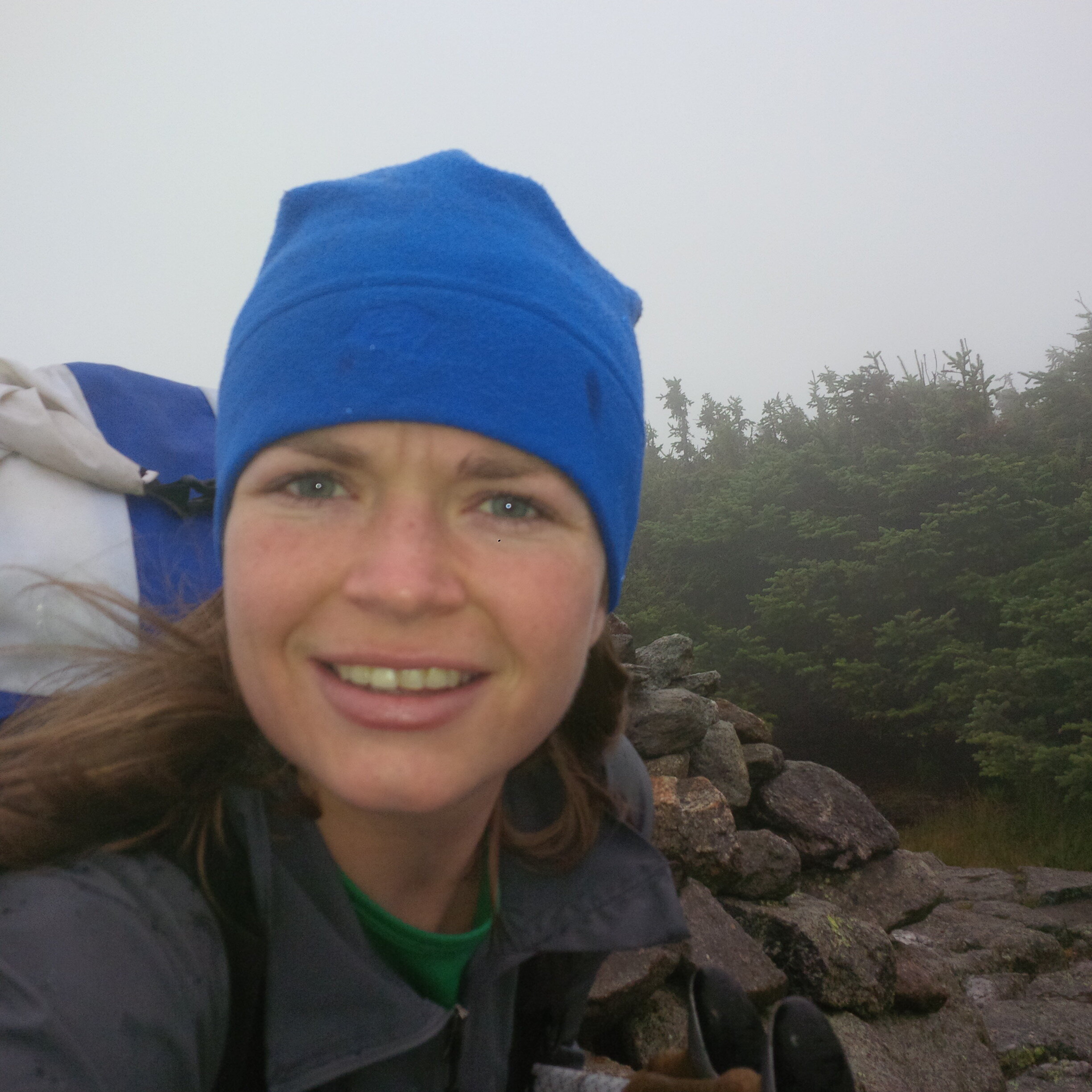
I am not warm
8/19-Glen Ellis Parking Lot → Imp Shelter–12.0 mi- +5732’ -4570’

Peaks: Wildcat D–11:45, Wildcat–12:54, Carter Dome–15:37, South Carter–16:46, Middle Carter–17:20
I woke up in the middle of the night and all I could see was a blue rectangular view of the courtyard outside. I was confused by how I managed to set up my tarp in a way that allowed me to see outside like that. It took me a moment to realize I was in a bed, under a roof, looking out a window. All I had to do to get up and pee was open the door of my room and walk down the hall to the bathroom. This was way better than my normal routine. I wasn’t carrying any camp shoes so I would have to find my (usually soaked) trail runners, put them on and crawl out from under my tarp. In the shelters, I would try not to wake the other 45 people in the shelter as I got up. Talk about luxury.
When I woke up in the morning my thigh was feeling better and I was excited about the breakfast in Pinkham Notch. I was ready to devour more than I’d ever eaten there before. I’m a sucker for freshly baked bread and I spend quite a bit of time thinking about the great bread I’ve had in VT and NH. I’d given up on getting to Gorham by the end of the day well before it started, sometime the day before when my leg was cramping up. I’d hiked the Wildcats but not the Carters before, so I had an idea of what I was in for. The whole range is steep and rough until Gorham, where I was originally planning on spending the night. Since I stayed at Joe Dodge, I now planned to pick up my maildrop in town and keep going. This meant I would have a short day. I slept until about 7:30, got packed up, and then hung out at the breakfast buffet for about two hours.
After I stuffed myself full of eggs, breakfast meats, bread, milk, juice, and coffee, I got some more coffee and an egg sandwich to go. I headed south on Rt 16 back to Glen Ellis to start my way up Wildcat. Some guy watched me look like a fool, rock hopping across the river with my poles under one arm, bagel in hand, and a cup of coffee in the other. I made it across without spilling or dropping anything and headed up the steep ascent of Wildcat. It gains about 2000’ in a mile and is the steepest ascent on the Appalachian Trail. It was clear hiking up, but there were some clouds hanging on to Mt. Washington across the street. By the time I made it to the Wildcat D summit, most of the clouds had burned off. I crossed the ridge and got to Wildcat A, then dropped down to Carter Notch and stopped into the hut.
I walked in and the croo member cooking for the day greeted me by asking if I wanted some turkey. Yes. I sat down and ate about a pound of deli-sliced turkey. After I finished all the turkey, I left to get ascending Carter Dome. The scenery in Carter Notch is hard to beat, with the lakes nestled under the rocky Ramparts. The ascent starts off very steep, and the grade levels towards the top. I stopped at a viewpoint that looked back down toward the Carter Hut. I got to the Carter Dome summit and ran into a thru-hiker who borrowed my phone to make plans to meet a friend. My poles had become a nuisance in negotiating up and down the rocky chutes that are all over the Carter range. My solution was to start throwing them up and down the rock chutes. After plenty of pole chucking, I made it to Imp Shelter.
It was a mix of thru-hikers and college orientation groups. I made dinner and chatted with the folks around. A Sobo asked if the cold weather had been making my trip more difficult. I'd prefer the cooler weather when I'm hiking all day, so I said it's been helpful. Hiking during hot and humid days is harder for me. Imp had a partially overgrown view west with a bench where I watched the sunset.

What’s up, Red Mac?
8/20-Imp Shelter → Madison campsite–15.9 mi- +6519’ -5686’

Peaks: Moriah–08:43, Madison–18:19
Another crisp morning and a chilly start. It was a complete bluebird day as I came over the ridge from Imp up to the summit of Moriah. It's a far cry from the last time I was here, when I got poured on the entire way from Route 2 to Imp Shelter on the AT the previous fall.
Once I got to the bald summit of Moriah, I sat and soaked in the views of the northern Presidentials. I would hike towards them after descending into Gorham. I got cold quickly once I stopped so I got moving again down the Carter-Moriah Trail. The Carter-Moriah Trail was dry with a grippy slab that allowed me to make great time down into Gorham. My feet are starting to ache when I'm descending on rocks. The trail into Gorham continued to mellow and become soft dirt in an open pine forest, a rare and welcome treat in the Whites. I love hiking in those forests and few trails in the area are like that. It's also much softer and easier on my feet than rocks. I wound up in a neighborhood when I got to the trailhead and walked over a footbridge that would take me into town.
I got into Gorham around 11 am. I stopped at the post office first to pick up my maildrop, then added some smoked meats and cheese to complement the food I'd mailed myself. That Cabin Fever Maple Whiskey I had at Beaver Brook Shelter was still something I was thinking about a lot. The liquor store had it in nips and I bought a few. Once I finished my errands, I walked to the southwestern edge of town to look for the start of the Pine Mountain Trail. Once I found the trailhead, the trail was easy to follow, but the blazes kept changing color. There was a great viewpoint at Chapel Rock near the summit of Pine Mountain. I stopped for a break and to get views towards where I was headed next. There's a village at the top of the mountain, but the dirt road that was most direct to get to the Pine Link Trail didn't take me through it.
I filled up my water bottles at the base of the trail and began the long, long ascent of Madison via Howker Ridge. I loved the hike up Pine Link to the Howker Ridge Trail. I hiked up with the idea of finding a campsite before Madison, but I still felt great on ascents and hiked up to the summit. I dropped down to the hut to fill my water bottles and found the bustle of dinner service when I got in. I didn't stay long and headed down towards the Valley Way campsite. I stopped at an overflow site where two thru-hikers were already staying. T-Bone and Porkchop had started the AT in Baxter State Park, like most Sobos, but they didn't hike Katahdin when they were there because Porkchop was having some issues with tendonitis from their pre-hike training.
They had a tarp made of the same material as my groundsheet, polycryo. It’s a clear plastic material slightly thicker than saran wrap. I was surprised to see anyone using it for a tarp, but I bet it's super light. I used some of their guylines to get my opaque tent set up and then we hung out and chatted before we all went to bed. There was some commiseration about being turned away for work for stays by the hut croos for seemingly arbitrary reasons. They said they were turned away at Madison because 4 pm was “too early” and the croo didn’t think they’d hiked far enough that day. So it goes.

Washington, the Great Gulf and Adams from Madison
8/21-Madison campsite → Starr King campsite–15.7 mi- +3074’ -5512’

Peaks: Adams–08:29, Jefferson–10:10
T-Bone and Porkchop got up and packed earlier than I did, but they were still up at Madison Hut by the time I got there. I had two cups of coffee (obviously) before starting up Adams, which has always been one of my favorite peaks. It’s only about 500 feet lower than Washington, so the weather is often close to the intensity of Big George and it doesn't have all the crap on top. It's another prime example of a rock pile as well. It's a fairly steep ascent up a pile of boulders churned up by the last pass of the glaciers through the area. Nothing but the wind when you get on top.
I took some pictures of the Great Gulf and Mt. Washington before descending and running into T-Bone and Porkchop one last time. They continued on the AT towards Mt. Washington, and I branched off on the Jefferson Loop to get to that summit. It was becoming more and more painful to descend. My feet are getting so sensitive after two weeks on these rocks. A group of guys was at Edmands Col when I got down there. They offered me all their snacks, so I ate them.
The descent down the Castle Trail was stunning, but the pain on the bottom of my feet was getting excruciating. It was amongst the most difficult few hours of my hike. I was dropping my poles down rock chutes again for part of the way down while making sure I wasn’t going to nail some unsuspecting hiker.
I don’t have much to say about the long road walk. I saw an amusement park and filled my water bottles at a pleasant spring. Walking on the pavement wasn’t helping my feet, but it was less painful than my descents of the Castle Trail and Glen Boulder.
I got a mediocre slice of pizza at the gas station next to the trailhead, then set off into the woods and found a place to camp for the night.

Jefferson summit pin and Mt. Washington
8/22-Starr King campsite → Cabot → Cabot Cabin–14.6 (+0.4) mi- +6286’ -4514’
Peaks: Waumbek–09:45, Cabot–15:31
I camped close enough to the trailhead to make it worth walking back to get some breakfast in the morning. Their pre-cooked, fast-food style egg sandwiches were bad. I’ve hiked 200+ miles over 46 peaks in the last couple of weeks and I’ll eat almost anything, so it says a lot about any food I don’t like right now. Not that I didn’t eat it anyway. It definitely wasn’t what I had been daydreaming about since I’d found out there was a place with breakfast. Getting some milk to mix with the protein powder I’d been mixing with water was quite a treat though. Like a strawberry milkshake.
I procrastinated getting on the trail while I talked to a guy at the Waumbek trailhead for a while. As usual. He even mentioned that it surprised him I hadn’t set off for my last two peaks already, but I wasn’t in a rush. The Starr King trail up to Waumbek was mellow compared to the terrain I’d been on since leaving Crawford Notch. The Kilkenny Ridge Trail was another one I’d read that was overgrown and difficult to follow. I think it’s had some recent trail work done, but I found it to be a remote and beautiful hike through old ferns and remote forest. It had a much different feel than a lot of the Whites. There was still quite a bit of up and down going over the three Weeks peaks. It wasn’t THAT different. The summit of Middle Weeks was a little confusing, but I found my way quickly after a wrong turn.
The entire day comprised of hiking in a green tunnel. It was foggy and cool, with some occasional drizzle. There was more consistent cloud cover than the last few days. I imagined conditions were similar on Mt. Washington to the day I was up there. There were some more PUDs going over Terrace Mountain. My feet were still very sore, but it was amazing the difference walking on dirt for the day made. There was much more moss and lichen along the trail than I was used to seeing. I knew water was scarce around Cabot Cabin, so I hiked down the Bunnell Notch Trail until I hit a stream and filled up my water bottles before heading up to the cabin.
After my walk through the enchanted forest, I made it to Cabot Cabin. I stopped in and found a few packets of ginger drink powder, which I mixed with my Cabin Fever Maple Whiskey before I set off for the Cabot summit. I stood at the rock cairn and behind the summit sign and celebrated with my a shot and my cocktail. It tasted like victory. I didn’t know what to do next. I hiked back to the cabin and had another ginger-maple drink before going to bed.

Seriously, go try some maple whiskey